
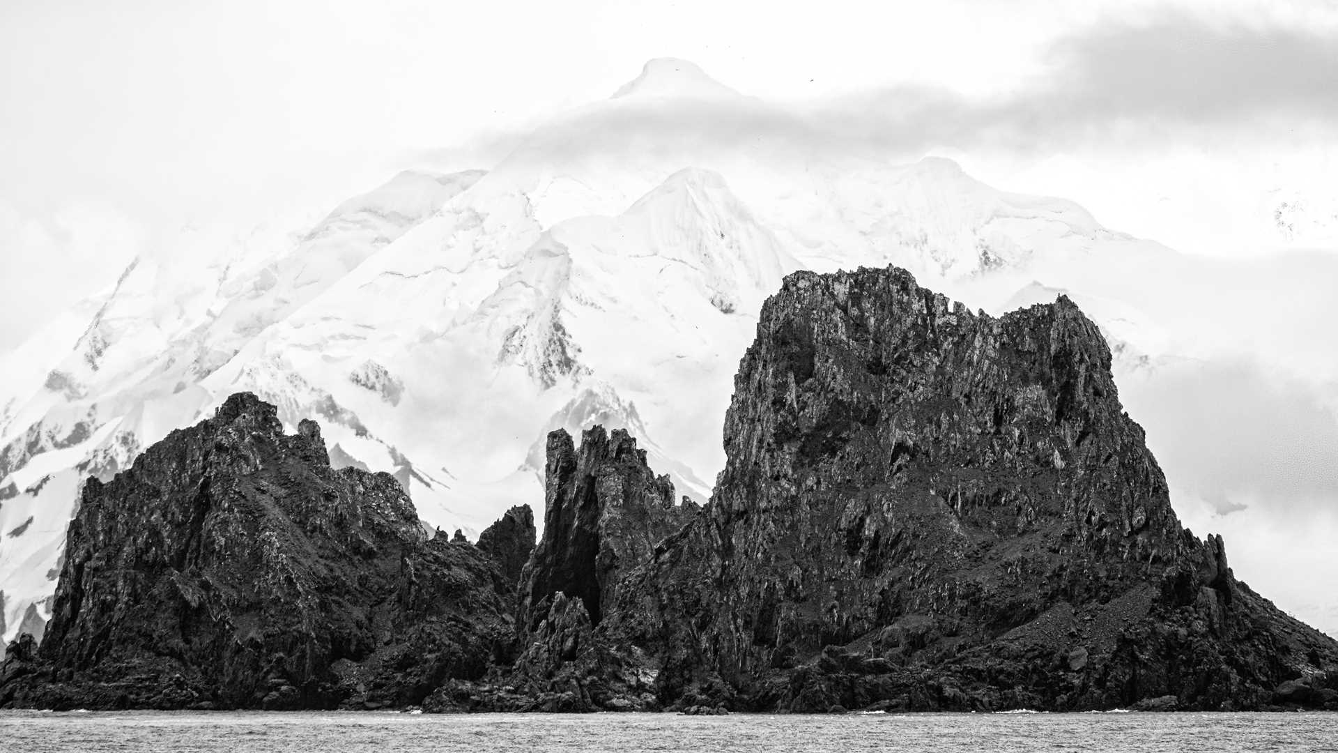
National Geographic Resolution made it down to the Antarctic Peninsula today! We started the day with land operations on a very windy Half Moon Island. We all got our first chance to watch chinstrap penguins coming and going to the sea. In the afternoon, we repositioned to Deception Island. We went ashore at Whalers Bay for a chance to stretch our legs and learn about some of the leftover relics from a whaling station and a British base.
- Daily Expedition Reports
- 20 Jan 2022
Half Moon Island & Deception Bay, 1/20/2022, National Geographic Resolution
- Aboard the National Geographic Resolution
- Antarctica
Nathan Kelley, Naturalist/Certified Photo Instructor
Nathan Kelley developed his love for nature as a kid at his family’s cabin in Northern Wisconsin. Family fishing trips, camping, hiking and a trip to his first National Park in the Everglades, all vigorously shaped his passion for the natural world. ...
Read MoreShare Report
Antarctica and Patagonia: Legendary Ice and Epic Fjords
VIEW ITINERARYRelated Reports
2/7/2022
Read
National Geographic Endurance
Pourquoi-Pas Island, Gaul Cove (Horseshoe Island)
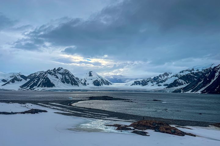
We woke up early this morning to take advantage of the calm weather. We set out to explore Pourquoi-Pas Island, named after Charcot’s second Antarctic expedition ship. We hiked up the island’s moraine to gain lovely views of the bay. We also enjoyed a leisurely walk along the shore. Along the way, we spotted a few more Adelie penguins, skuas with their chicks, kelp gulls, a Weddell seal and a crabeater seal swimming through the water. In the afternoon, we explored a brand-new area on Horseshoe Island, pioneering a new hike up one side and down the other into Gaul Cove. We enjoyed beautiful views of the cove and glacier. The hike was full of beautiful pink granite and stunning geological views all around.

2/4/2022
Read
National Geographic Endurance
Beethoven Peninsula, Alexander Island
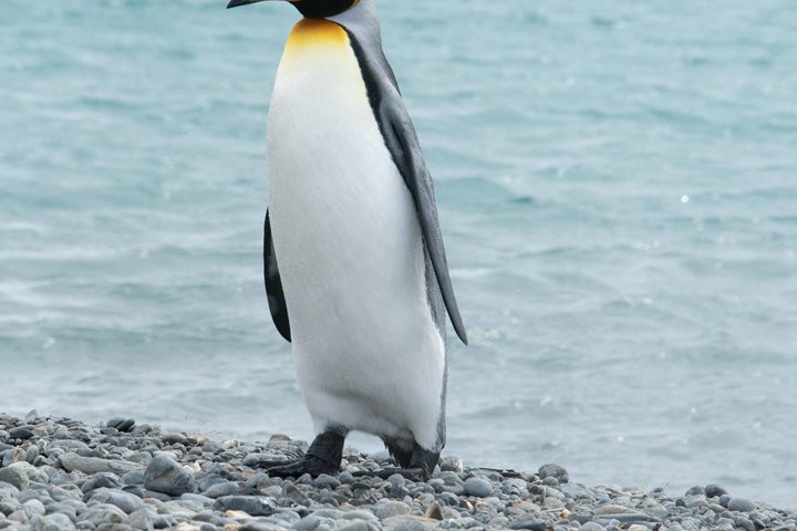
After leaving the Stange Ice Shelf and cruising up Carroll Inlet during the wee hours of the morning, we continued heading northward all day. As we made our way through open seas and moderate northerly winds in the morning, we had time for a couple of presentations in the Ice Lounge. We discussed the famous “Race to the Pole” between Amundsen and Scott, and the wonderful adaptations of the marine mammals we have observed. We are located in the southeast corner of the Bellingshausen Sea, the base of the west coast of the Antarctic Peninsula. This region, where the coastline turns west toward Marie Byrd Land and the Ross Sea, is entirely unfamiliar to the ships of our fleet. The icebound shores we see, the rocky islets, and the remote nunataks rising from the ice caps—it is all new to us, and it is particularly exciting for that reason. One of the great pleasures in exploring unknown places is making the association between the shapes and names I have seen on a map to the physical reality of standing (or cruising) on that spot on the globe. Seeing what it really looks like and feels like is exciting. I have wondered about names and places on the map of this region for years, and it’s a real delight to finally visit them and put faces to the names. Huge places like Alexander Island and little details of the crenellated corner of the Antarctic Peninsula: Smyley Island, the Carroll Inlet, Stange Sound and the Ryderfield Peninsula. Today’s journey took us around the huge Beethoven Peninsula, the southwest prominence of Alexander Island. As is the case with many Antarctic place names, there is a theme here: the many large bays and inlets are named for famous European composers. The Brahms Ice Shelf, the Mendelssohn Ice Shelf and so on. We spent this afternoon cruising among the enormous icebergs and floes of pack ice, observing seals and an emperor penguin in Verdi Inlet. On the largest scale, Palmer Land is the most exciting for me. The historic regional name was given to the southern half of the Antarctic Peninsula. Most of the continent is divided into pie slices. The slices bear unofficial names given by explorers of the heroic age or by later geographers to honor those same great men and women and their sponsors. Ellsworth Land, Queen Maud Land and Wilkes Land: they have always intrigued me and piqued my curiosity. The northern half of the Peninsula is Graham Land. In 21 years of visiting the Antarctic, I have never been outside its borders. Now we have cruised the full length of the coast of Palmer Land and come right to the corner of Ellsworth Land. The map has unfolded before us, and a new part of the planet has become real.